






Mittelstandspresse
17.09.2026
Banyan Gold Intersects 1.05 g/t Gold over 52.8 Metres and Bonanza-Grade Gold at Powerline Deposit, AurMac, Yukon, Canada
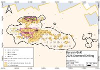
VANCOUVER, BC, 17.09.2026 (PresseBox) - Banyan Gold Corp. (the "Company" or "Banyan") (TSX-V: BYN) (OTCQB: BYAGF) - https://www.commodity-tv.com/ondemand/companies/profil/banyan-gold-corp/ - is pleased to report new results from western portions of the Powerline Deposit (“Powerline”), AurMac Project (“AurMac”), Yukon, Canada. Drillhole AX-26-892B intersected 1.05 g/t gold (“Au”) over 52.8 metres (“m”) and drillhole AX-26-891 intersected 149.14 g/t Au over 0.4 m, within a wider interval of 0.56 g/t Au over 169.2 m. The results demonstrate the potential to improve grade and continuity in known mineralized domains on the margins of Powerline’s near-surface higher-grade cores. The drilling forms part of Banyan’s ongoing 2026 drill program focused on resource conversion, expansion and delineation of higher-grade mineralized domains within and adjacent to the current Mineral Resource.
Highlights from Powerline:
AX-26-873 – 1.18 g/t Au over 8.3 m, within 0.51 g/t Au over 50.5 m
AX-26-876 – 1.15 g/t Au over 13.9 m within 0.44 g/t Au over 51.5 m, including 16.5 g/t Au over 0.3 m
AX-26-878 - 1.37 g/t Au over 11.8m, including high-grade of 7.37 g/t Au over 0.5m and 9.78 g/t Au over 1.0 m
AX-26-891 – 149.14 g/t Au over 0.4m and 0.63 g/t Au over 19.9 m, all within 0.56 g/t Au over 169.2m
For context, the 0.56 g/t Au over 169.2 m composite in AX-26-891 is materially influenced by the 149.14 g/t Au over 0.4 m interval. Excluding that interval, the remaining 168.8 m averages approximately 0.21 g/t Au with the lower mineralized zone of 0.63 g/t Au over 19.9m. High-densities of extensional quartz veins are present throughout the full interval.
AX-26-892B – 1.05 g/t Au over 52.8 m, within 0.87 g/t Au over 69.7 m
AX-26-895 – 1.01 g/t Au over 17.2 m within 0.73 g/t Au over 26.6 m; includes high-grade of 6.72 g/t Au over 0.6 m and 10.30 g/t Au over 0.5 m
“These results demonstrate the opportunity to improve the grade, extent and continuity of mineralized domains along the current margins of Powerline’s near-surface higher-grade cores,” stated Tara Christie, President and CEO. “Hole AX-26-892B returned 1.05 g/t Au over 52.8 m, while AX-26-891 intersected several higher-grade intervals, including 149.14 g/t Au over 0.4 m. Together, the results support our strategy of targeting areas that could improve the grade profile and confidence of the AurMac resource. Our 2026 and planned 2027 drilling will continue to test the extent and expansion potential of higher-grade domains.”
Lithological domains at Powerline are dominated by metasedimentary rocks of various compositions, typically mica-chlorite schists with varying calcareous content. Domains shown in this section are: CLSR_4 and 5 – chlorite-sericite schist; CSCH_1 and 3 – calcareous schist; and sch_2 – heterogeneous schist. Altered host rocks with intense silicification and meta-greenstones are preferential host for extensional quartz veining (Figures 9 and 11).
In addition to the AurMac Project, the Company holds the Hyland Gold Project, located 70 km northeast of Watson Lake, Yukon, along the southeast end of the Tintina Gold Belt (the “Hyland Project”) in the Traditional Territory of the Kaska Nations, closest to the Liard First Nation and Daylu Dena Council. The Hyland Project represents a sediment hosted, structurally controlled, intrusion-related gold deposit, within a large land package (over 125 sq km), accessible by a network of existing gravel access roads. The Hyland Project MRE comprises an Indicated Mineral Resource of 337 thousand (“K”) ounces (“oz”) of gold (“Au”) and 2.63 million (“M”) oz of silver (“Ag”) (11.3 M tonnes at 0.93 g/t Au and 7.27 g/t Ag), and an Inferred Mineral Resource of 118 Koz of Au and 0.86 Moz Ag (3.9 M tonnes at 0.95 g/t Au and 6.94 g/t Ag) (as defined in the 2014 CIM Definition Standards for Mineral Resources & Mineral Reserves incorporated by reference into NI 43‑101) effective September 1, 2025 and with a technical report filed on SEDAR+ on October 27, 2025.
Banyan also holds the Nitra Gold Project and Seattle-Goodman Creek Project which are grassroots exploration projects located in the Mayo Mining district, adjacent to the AurMac Gold Project. These properties lie in the northern part of the Selwyn Basin and are underlain by metaclastic rocks of the Late Proterozoic Yusezyu Formation of the Hyland Group, similar to lithologies hosting portions of the AurMac Project. Middle Cretaceous Tombstone Plutonic suite intrusions occur along the properties including the Morrison Creek and Minto Creek stocks. The properties are 100% owned by Banyan and cover over 530 sq km. The properties are accessible by road along the Silver Trail Highway, South McQuesten Road and a network of other smaller roads across the properties.
Banyan trades on the TSX Venture Exchange under the symbol “BYN” and is quoted on the OTCQB Venture Market under the symbol “BYAGF”. For more information, please visit the corporate website at www.banyangold.com or contact the Company.
FORWARD-LOOKING INFORMATION: This release contains forward-looking information, which is not comprised of historical facts and is based upon the Company’s current internal expectations, estimates, projections, assumptions and beliefs. Such information can generally be identified by the use of forward-looking wording such as “may”, “will”, “expect”, “estimate”, “anticipate”, “intend(s)”, “believe”, “potential” and “continue” or the negative thereof or similar variations. Forward-looking information involves risks, uncertainties and other factors that could cause actual events, results, performance, prospects and opportunities to differ materially from those expressed or implied by such forward-looking information. Forward looking information in this news release includes, but is not limited to, the potential for resource expansion and increased grades; mineral recoveries and anticipated mining costs. Factors that could cause actual results to differ materially from such forward-looking information include uncertainties inherent in resource estimates, continuity and extent of mineralization, capital and operating costs varying significantly from estimates, the preliminary nature of metallurgical test results, delays in obtaining or failures to obtain required governmental, environmental or other project approvals, political risks, uncertainties relating to the availability and costs of financing needed in the future, changes in equity markets, inflation, changes in exchange rates, fluctuations in commodity prices, and the other risks involved in the mineral exploration and development industry, enhanced risks inherent to conducting business in any jurisdiction, and those risks set out in Banyan’s public documents filed on SEDAR+. Although Banyan believes that the assumptions and factors used in preparing the forward-looking information in this news release are reasonable, undue reliance should not be placed on such information, which only applies as of the date of this news release, and no assurance can be given that such events will occur in the disclosed time frames or at all. Banyan disclaims any intention or obligation to update or revise any forward-looking information, whether as a result of new information, future events or otherwise, other than as required by law.
Ansprechpartner
Marc Ollinger
+41 (71) 354-8501
Datei-Anlagen:

(283 kB)
1629111.attachment
Figure 1: Plan map of AurMac, Yukon, Canada. Drillholes reported in this release highlighted in blue. Pending results are shown in green. Previously released 2026 drilling is shown in orange and all other diamond drilling in black. The reported holes extend higher-grade mineralized domains along the margins of Powerline’s near-surface high-grade cores.

(266 kB)
1629112.attachment
Figure 2: Plan map of Powerline South. Cross sections denoted by blue lines

(212 kB)
1629113.attachment
Figure 3: Plan map of Powerline Southwest. Cross sections denoted by blue lines

(179 kB)
1629114.attachment
Figure 4: Plan map of Powerline West. Cross sections denoted by blue lines

(333 kB)
1629116.attachment
Figure 5: Cross-section 466750mE through Powerline South at AurMac. Mineralized domains are overlaid on the lithological model. Mineralization remains open down-dip at depth, with the high-grade interval in AX-26-891 (Figure 5) highlighting the potential to extend mineralized domains and upgrade domains on the margins of high-grade cores.

(175 kB)
1629117.attachment
Figure 6: Cross-section 466100mE through Powerline West at AurMac. Mineralized domains are overlaid on the lithological model. Mineralization remains open down-dip at depth and highlights the potential to extend mineralized domains and upgrade domains on the margins of high-grade cores. The MRE block model is constrained by mineralized and lithological domains.

(162 kB)
1629118.attachment
Figure 7: Cross-section 466250mE through Powerline Southwest at AurMac. Mineralized domains are overlaid on the lithological model. Mineralization remains open down-dip at depth, highlighting the potential to extend mineralized domains and upgrade domains on the margins of high-grade cores.

(206 kB)
1629119.attachment
Figure 8: Cross-section 467000mE through Powerline South at AurMac. Mineralized domains are overlaid on the lithological model. Mineralization remains open down-dip at depth, highlighting the potential to extend mineralized domains and upgrade domains on the margins of high-grade cores within Powerline.

(756 kB)
1629120.attachment
Figure 9: Mineralized extensional quartz veins in metasedimentary rocks in Powerline South from diamond drillhole AX-26-891. The large gold grain at 71.95 m is associated with Bonanza grade assay of 149.14 g/t Au over 0.4 m from an extensional quartz vein with arsenopyrite and sulphosalts, within a wider interval of 0.56 g/t Au over 169.2 m.

(2 MB)
1629121.attachment
Figure 10: Visible gold occurrences in extensional quartz veins from Powerline: Top left: gold grain intergrown with arsenopyrite and sphalerite – AX-26-891 at 134.4 m. Top right: gold grain intergrown with acicular bismuth sulphosalts – AX-26-891 at 150.6 m. Bottom left; gold grain with spatially associated arsenopyrite aggregates – AX-26-891 at 162.2 m.

(675 kB)
1629122.attachment
Figure 11: Mineralized extensional quartz veins in metasedimentary rocks in Powerline South from diamond drillhole AX-26-892B. High-density of large extensional quartz veins (>3 veins/m) with bismuth-sulphosalts, arsenopyrite, and pyrite are present throughout the interval from 87.6-140.4m, with multiple instances of visible gold (Figure 12).

(2 MB)
1629123.attachment
Figure 12: Visible gold occurrences in extensional quartz veins from Powerline: Top left: gold grains intergrown with bismuth sulphosalts – AX-26-873 at 53.5m. Top right: gold grains intergrown with acicular arsenopyrite and bismuth sulphosalt masses – AX-26-873 at 138.4 m. Bottom left: gold grain in extensional quartz vein with spatially associated arsenopyrite – AX-26-892B at 88.4m. Bottom right: visible gold grain intergrown and associated with arsenopyrite grain – AX-26-892B at 101.8 m.
- Mehr Infos zu dieser Meldung unter www.pressebox.de
- zurück zur Übersicht